|
|

|
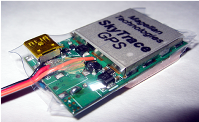
| RC Altimeter 2 with FXJ Switch |
| Magellen Technologies now carries the RC Altimeter 2 with FXJ Switch. |
SkyTraceGPS RC GPS Logger
Register your SkyTraceGPS
New Registration Instructions
|
||||||||||||||||||||||||||||||||||||||||||||||||||||||
| Overview | ||||||||||||||||||||||||||||||||||||||||||||||||||||||
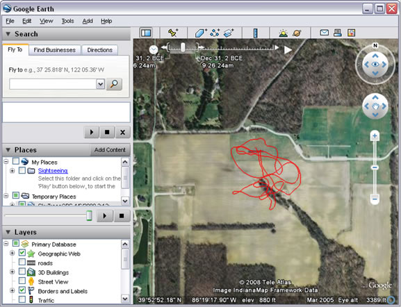
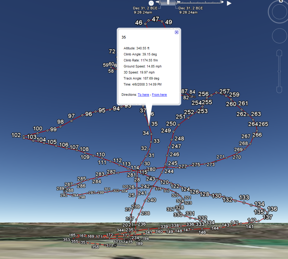
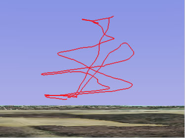
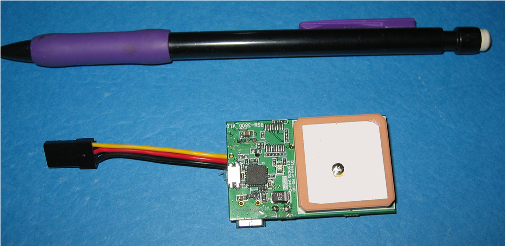
The SkyTraceGPS is a small on-board device which records the latitude, longitude, ground speed and altitude every second. Each time the SkyTraceGPS is powered up it starts a new log file. These log files can be downloaded to a Windows PC where the data can be analyzed and viewed in Google Earth. More than just an altitude logger. Typical altitude loggers show various altitude and time calculations such as climb rate, the SkyTraceGPS can also show climb angle, ground speed, distance flown, track angle and more. Now you can see the speed at minimum sink, the climb angle at maximum climb rate, sink rate at a specific speed and much more. What happened to the sink rate and speed when you added 5deg camber? Now you know! The export to Google Earth is not just for pretty pictures. Click on any point on the flight path and see the data for that point: altitude, climb/sink rate, climb/sink altitude, speed and more. Catch a big thermal way down wind? Now you can see the ground features below the plane where you found the lift. See for yourself. Go to the downloads page and try out the SkyTraceGPS software (you can load the saved filght file) and the Google Earth kml file. |
||||||||||||||||||||||||||||||||||||||||||||||||||||||
|
||||||||||||||||||||||||||||||||||||||||||||||||||||||
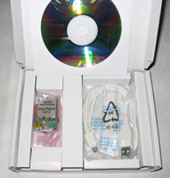
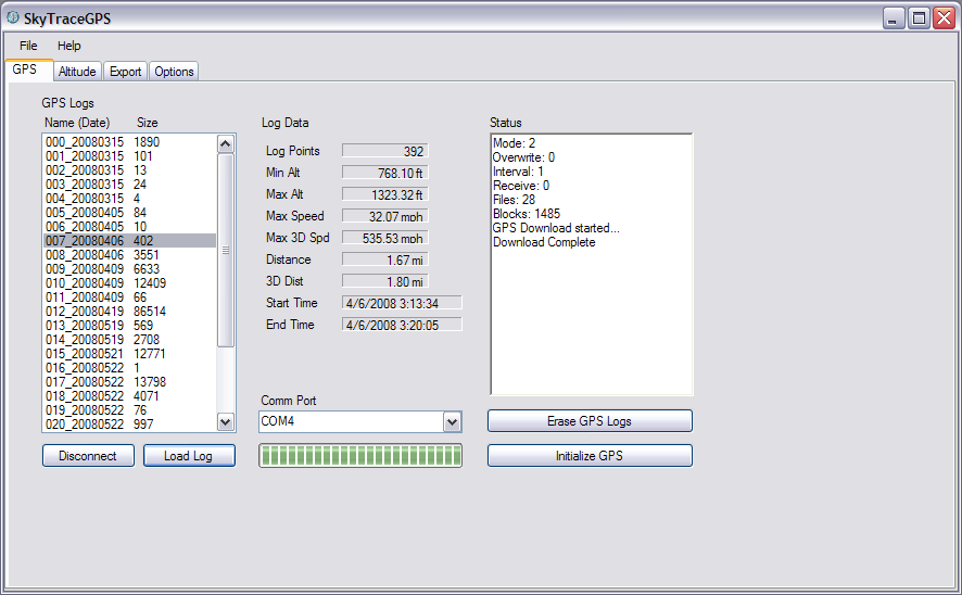
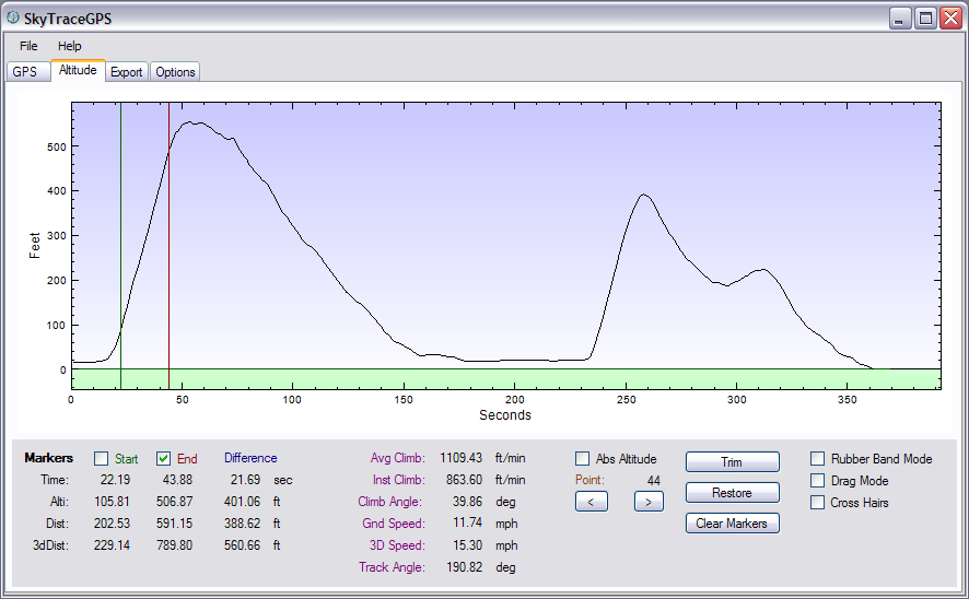
| SkyTraceGPS Windows Software | ||||||||||||||||||||||||||||||||||||||||||||||||||||||
Runs on Windows XP or Vista Downloads or calulates the following data for each point:
Displays Altitude / Time Graph similar to barometric altitude data loggers but by clicking on any point the following data is also displayed:
Esports data to Google Earth displaying the flight track and all data points. By clicking on any point in Google Earth, the altitude, speed, climb rate, climb angle and other data are displayed. Software status: We are currently at version 1.1. There are no known bugs. In a few months we plan to have version 2.0 with an enhanced user interface. |
||||||||||||||||||||||||||||||||||||||||||||||||||||||
|
||||||||||||||||||||||||||||||||||||||||||||||||||||||
| GPS Datalogger Technical Specifications | ||||||||||||||||||||||||||||||||||||||||||||||||||||||
|
|
Copyright Magellan Technologies, Inc., 2007-2009 |

![]()
![]()
![]()
![]()
![]()
![]()
